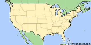
| Country: | United States |
|---|---|
| State: | Indiana (IN) |
| Lat/Long: | 39°06'N / 84°51'W |
| Elevation: | 146 m |
| Currency: | United States Dollar (USD) |
| Languages: | English |
| Country Code: | +1 |

Holiday Note: 1月9日 (木), National Day of Mourning for Jimmy Carter. Businesses may be closed. See more
More Sun & Moon in Lawrenceburg
+ Show More Twilight and Moon Phase Information
Solar Noon
Sun in South: 12時46分
Altitude: 28.9°
Altitude: 28.9°
Astronomical
Twilight
6時23分 – 6時55分
18時37分 – 19時10分
18時37分 – 19時10分
Nautical
Twilight
6時55分 – 7時28分
18時04分 – 18時37分
18時04分 – 18時37分
Civil
Twilight
7時28分 – 7時58分
17時35分 – 18時04分
17時35分 – 18時04分
Previous
Moon Phase
First Quarter
2025年1月6日月曜日
18時56分
2025年1月6日月曜日
18時56分
Next
Moon Phase
Full Moon
2025年1月13日月曜日
17時26分
2025年1月13日月曜日
17時26分

Tools & Converters

Calendar & Holidays
Create the United States calendar
Upcoming Holidays

Airports
- Cincinnati/Northern Kentucky International Airport, CVG
About 16 km ESE of Lawrenceburg - Indianapolis International Airport, IND
About 142 km WNW of Lawrenceburg - Dayton International Airport, DAY
About 105 km NNE of Lawrenceburg - Blue Grass Airport, LEX
About 119 km S of Lawrenceburg - Louisville International Airport, SDF
About 128 km SW of Lawrenceburg - John Glenn International, CMH
About 196 km ENE of Lawrenceburg

Lawrenceburg
USA
15時17分24
2025年1月9日木曜日


